UN
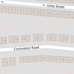
157 Coronation Road
£ 130,000
Description
We don't have a Description for this property.
- Bedrooms
- 3
- Bathrooms
- 0

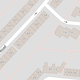


Leaflet © OpenStreetMap contributors
The heatmap indicates the level of crime in the area. The color of the heatmap indicates the crime severity and recency.
Metrics Year-on-Year
- Average area value
- 202,431.00 £Increased by 1.44 %
- Average area rental value
- 1,233.00 £/moIncreased by 17.09 %
- Est rental Yield
- 7.31 %Increased by 15.48 %
- Crime Rate
- 24.00 %Unchanged by 0.00 %
from 199,565.00 £
from 1,053.00 £/mo
from 6.33 %
from 24.00 %
Nearby Schools
| Name | Type | Ofsted | Distance |
|---|---|---|---|
| Richmond Academy | Academy Sponsor Led | Requires improvement | 0.33 KM |
| Seashells Children'S Centre | Children's Centre | 1.31 KM | |
| Rose Street Primary School | Community School | Good | 1.31 KM |
| St Edward'S Catholic Primary School | Academy Sponsor Led | Good | 1.61 KM |
| Halfway Houses Primary School | Academy Converter | Good | 1.68 KM |
Images
Nearby Streets
| Name | Average Price | Average Sqft | Distance |
|---|---|---|---|
| Nursery Close | £ 280,000 | 0 | 0.00 KM |
| Alma Street Passage | £ 0 | 0 | 0.00 KM |
| Halfway Road | £ 300,000 | 0 | 0.00 KM |
| Barnsley Close | £ 240,000 | 0 | 0.00 KM |
| Holland Close | £ 130,000 | 0 | 0.00 KM |
Nearby Transport
| Name | NLC | TLC | Distance |
|---|---|---|---|
| Sheerness-On-Sea | 5184 | SSS | 1.49 KM |
| Queenborough | 5176 | QBR | 3.38 KM |
| Swale | 5249 | SWL | 5.95 KM |
| Kemsley | 5205 | KML | 9.20 KM |
Nearby Listings
| Address | Price | Type | Score | Distance |
|---|---|---|---|---|
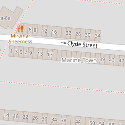
| Unity Street, Sheerness | £ 150,000 | BUY | 5 / 10 | 0.07 KM |
| Unity Street, Sheerness | £ 180,000 | BUY | 6 / 10 | 0.09 KM |
| Clyde Street, Sheerness | £ 185,000 | BUY | Unknown | 0.13 KM |
| Unity Street, Sheerness | £ 150,000 | BUY | 6 / 10 | 0.15 KM |
| Clyde Street, Sheerness, Kent, ME12 | £ 165,000 | BUY | 6 / 10 | 0.16 KM |
Nearby Properties
| Address | Price | Distance |
|---|---|---|
| 98 Coronation Road | £ 142,500 | 0.00 KM |
| 145 Coronation Road | £ 151,000 | 0.00 KM |
| 157 Coronation Road | £ 130,000 | 0.00 KM |
| 117 Coronation Road | £ 99,995 | 0.00 KM |
| 137 Coronation Road | £ 222,500 | 0.00 KM |